 Overview
The lake level of Lake Wimauma, located in southern Hillsborough County, Florida, has varied by 15 feet over the last few decades, often leaving the lake as two separate pools. As part of an effort to determine a minimum lake level, Water & Air developed water budgets for Lake Wimauma and nearby Carlton Lake for the Southwest Florida Water Management District. There was concern that geophysical anomalies beneath or near Lake Wimauma were providing a seepage pathway to the Floridan Aquifer whose head potential has been reduced locally by approximately 50 feet over the last half century. Historical limnological and geological literature and reports were reviewed before developing an approach to calculate water budgets and perform geophysical surveys. The following water budget components were measured or calculated for monthly intervals: precipitation, rainfall, runoff, overflow from the East Pool to the West Pool, near-shore seepage, “far-shore” seepage (vertical leakage), evapotranspiration, change in lake volume, and residual. Marine surveys using electrical resistivity and seismic reflection were performed to identify subsurface anomalies.
Task Summary
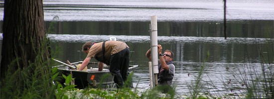
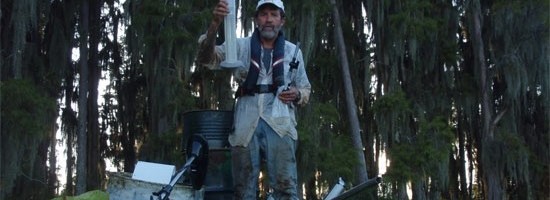
- Installed data logging pressure sensors at both pools of Lake Wimauma
- Monitored rainfall, lake level, and barometric pressure in Carlton Lake to quantify individual rainfall events, lake stage changes, runoff inflows, overflow between pools, and change in lake volume.
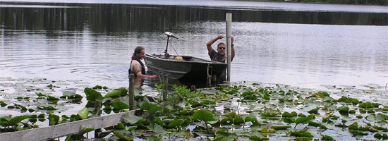
- Deployed seventeen near-shore seepage meter stations in the three water bodies to monitor seepage inflows and outflows and identify a substantial area of the West Pool where groundwater recharge was occurring.
- Installed eight “far-shore” seepage meters in the West Pool to identify areas with substantial groundwater recharge.
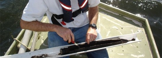
- Collected bathymetric measurements and mapped sediment types to refine seepage meter placement.
- Locate geophysical transects for electrical resistivity and seismic reflection measurements using seepage and bathymetric measurements.
- Interpolated hydrostatic head potential at each lake using Floridan Aquifer wells.
- Installed shallow piezometers around the lakes and created potentiometric maps to help interpret groundwater flow.
Results
The water budget for Carlton Lake yielded a difference between the inputs and the outputs of 0.90 inches per year. Seepage into the East Pool was calculated to contribute +13.7 inches, or 19.7% of the total annual input. In the West Pool, seepage near the shore was calculated to contribute +5.85 inches, or 8.9% of the total input, while seepage further from shore drained the pool of approximately -10.86 inches, or 16.3% of the total output. In-lake and terrestrial piezometers indicated lower head potentials near areas of greatest seepage from the West Pool which also were collocated with some geophysical anomalies.